In early September 2025, local communities living along the southern fringe of Parsa National Park in Nepal began reporting tiger movement near human settlements.
For the Divisional Forest Office (DFO) and Parsa National Park (PNP), the reports raised an urgent question: how could they turn early reports of tiger movement into action quickly enough to protect both people and tigers?
Real-time monitoring cameras
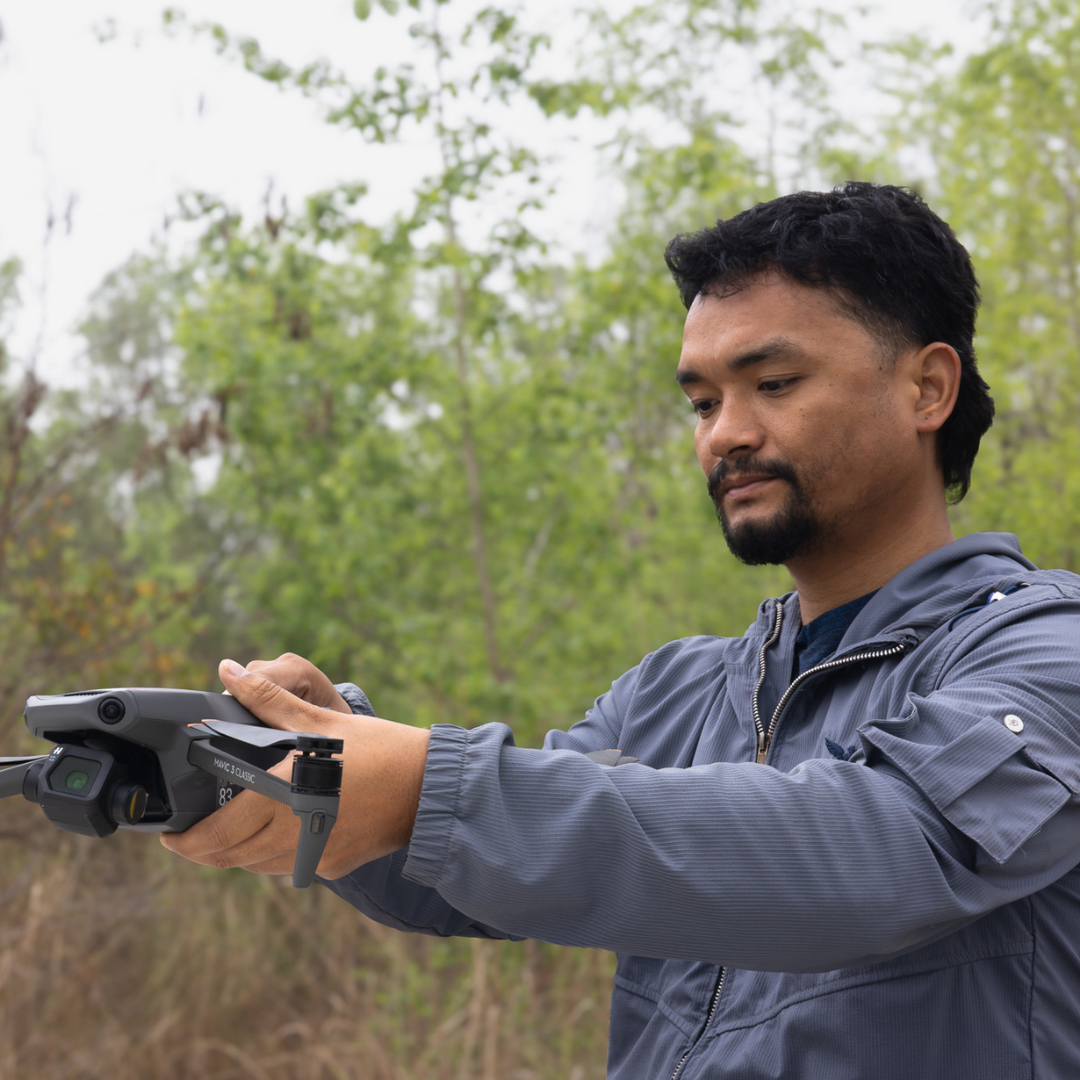
To help answer this, officials asked ZSL Nepal to help by installing real-time monitoring cameras in forested areas close to the reported sightings. The ZSL team mobilised quickly knowing the potential severity of the situation and deployed three cameras. Unlike conventional camera traps, which must be checked manually, real-time cameras can transmit images soon after they are captured. This makes them a powerful tool in human-wildlife conflict hotspots, where early information can help authorities and communities respond before an encounter takes place.
The camera locations were chosen carefully, through consultation with the National Park Officials, DFO and local community representatives. This ensured that the monitoring effort was guided by both technical expertise and local knowledge.
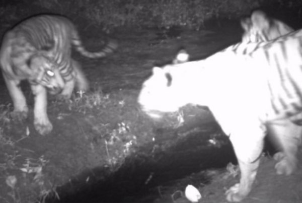
Less than three weeks later, one of the cameras sent through an image that confirmed the communities’ fears, a tigress with two cubs, photographed near a water source. The image was good news for tiger conservation as it showed tigers were reproducing, but it also signalled immediate risk. A tigress with cubs can be highly protective, and the area where she was recorded lies close to communities that depend on the surrounding forest for grazing, fodder and other daily needs.
To make matters more urgent, Dashain, one of the most important Hindu festivals of the year, was due to begin just eight days after the image was captured. During the festival period, people in forest-edge communities may enter the forest more often to collect forest products, gather ritual items and graze livestock. That meant more people could be moving through the same landscape as the tigress and her cubs. The teams had to work quickly.
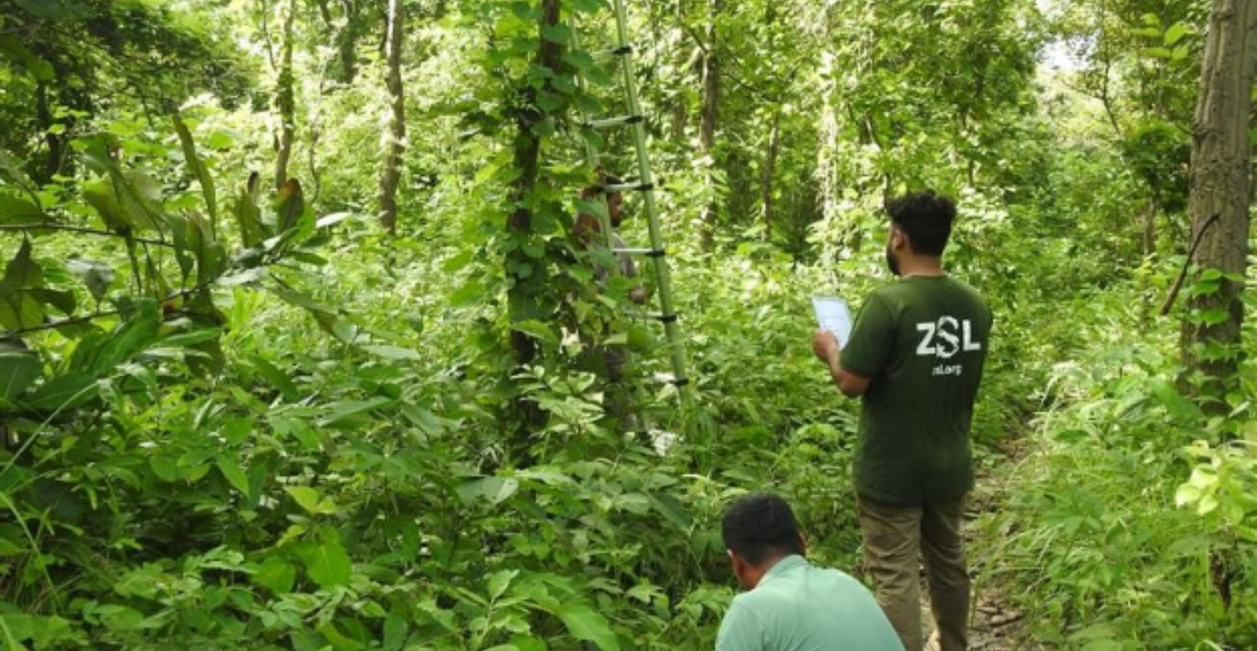
Field staff deploying a real-time camera – Image from ZSL Nepal
Tiger profiling
When the photograph of the tigress and her cubs came through, the team needed to understand more about the animals they were seeing.
Tiger stripe patterns are unique to each individual, so the team compared the image captured on 21 September 2025 with photographs from Nepal’s 2022 National Tiger Survey catalogue. By looking closely at the stripe patterns on the tigress’s left flank, they were able to match the new image with a female tiger previously recorded during the national survey, except this time she was accompanied by two cubs estimated to be between one and two years old.
The earlier and more recent records were both from the southern fringe of Parsa National Park, outside the park’s core area. The two camera locations were around 4.75 kilometres apart, suggesting that the tigress had remained within the same wider landscape over time.
For the response team, this information mattered. It showed that the tigress was not simply passing through an unfamiliar area but using a forest-edge landscape where people also regularly move, graze livestock and collect forest resources. Combined with the presence of cubs, this made rapid, targeted action even more important.
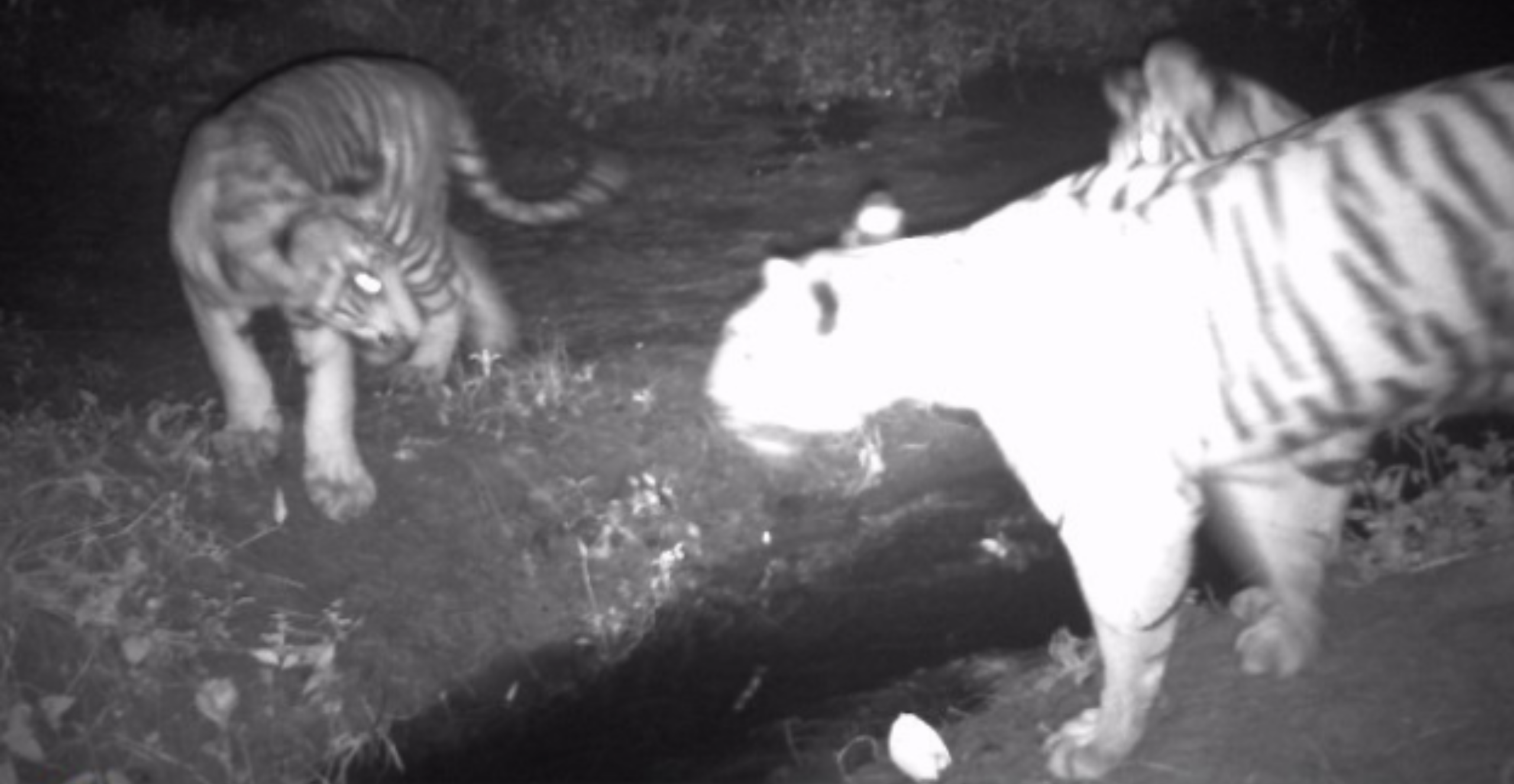
Image of the tigress with her cubs from the early warning camera – Photo from ZSL Nepal
Mapping the highest risk areas
The team then mapped where the risk to people was greatest by plotting the location of the historic and recent camera trap images of the tigress with previous human tiger conflict records from the surrounding area, satellite imagery of settlements, field observations and local information of forest access routes.
This helped the team chart where people were most likely to overlap with the tigress’s movement range. This was especially important because the wider area already had a history of serious conflict, including human casualties from tiger attacks and retaliatory killings of tigers. The risk was made more complex by the fact that many households depend on nearby forests for subsistence, with few alternative livelihood options.
One settlement was found to be just 900 metres from where the tigress had been recorded, placing it well within a potential movement area with an additional eight other settlements also identified as vulnerable.
The team also identified five key forest entry points and human activity corridors regularly used by local communities which represented places where people were most likely to unknowingly move into the same area as the tigress and her cubs.
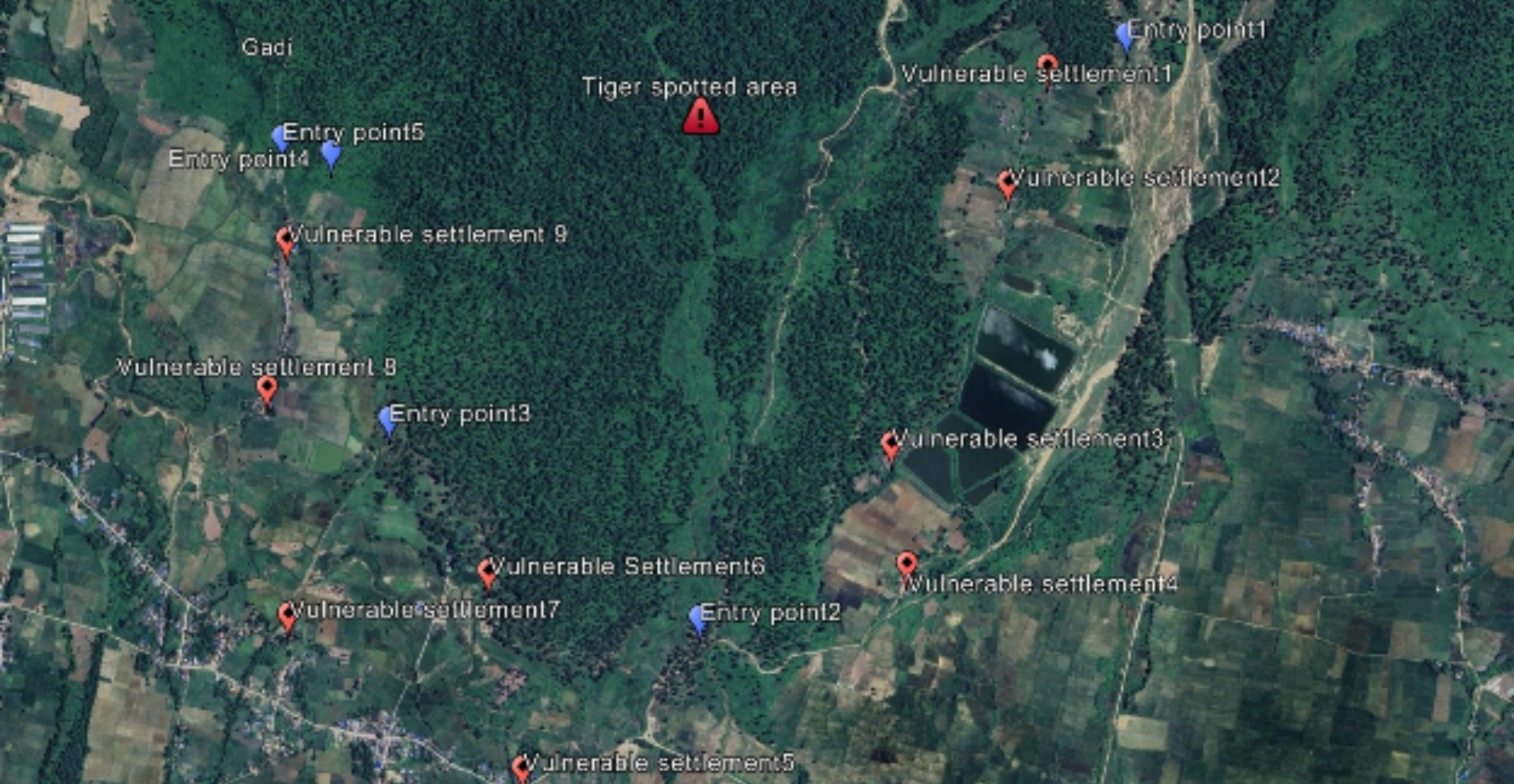
Most at risk areas mapped – Image from ZSL Nepal
A coordinated response
With the highest-risk settlements and forest entry points identified, the team was able to move quickly from detection to action focusing efforts on those most at risk.
Given the presence of a tigress with cubs, the area’s history of human-tiger conflict, and the approaching Dashain festival, the teams agreed that a proactive and carefully coordinated response was essential. However, the team needed to manage information sensitively to avoid panic, disturbance or people attempting to locate the animals, therefore, the exact location of the tigress and cubs was not shared publicly. Instead, the planned messaging focused on practical ways to reduce the risk of encounters such as taking care when entering forest areas, avoiding risky routes, recognising warning signs, protecting livestock and reporting wildlife signs quickly.
The most urgent recommendation was to deliver this messaging in the nine vulnerable settlements and at the five forest entry points identified through the mapping process, before festival-related forest use increased. The awareness sessions were delivered through household visits, small group discussions were also held in community spaces such as tea stalls, schools, community halls and other public gathering places and temporary information boards were installed where appropriate.
Thankfully, the project had already helped establish a local network of trained community volunteers who could support exactly this kind of response. Known as Bagh Mitras, or “Friends of Tigers”, these volunteers had been set up through ZSL Nepal and supported by WildCats Conservation Alliance. The initiative was central to the response with the Bagh Mitras mobilised across the vulnerable sites to act as frontline communicators, helping to share safety messages, support risk reduction and provide feedback from the ground. They were equipped with awareness materials, basic safety equipment, and emergency contact numbers.
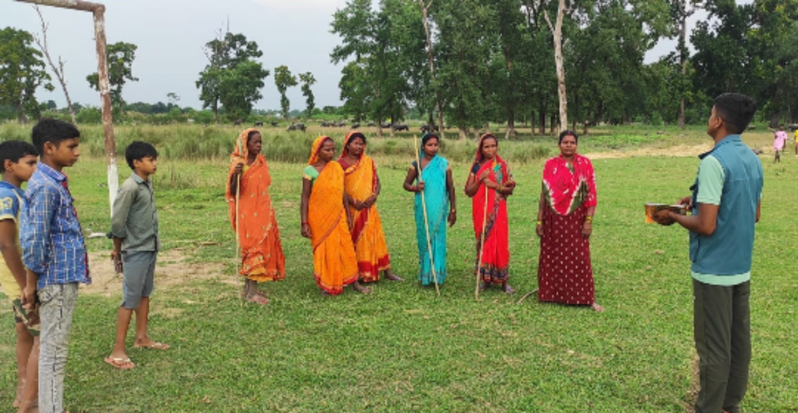
Bagh Mitra response – Image from ZSL Nepal
Conservation outcome
The response showed how quickly a single camera-trap image can lead to practical conservation action when the right systems are already in place and collaboration between stakeholders is utilised.
For local communities, this meant receiving timely information ahead of a period of increased forest use. For conservation teams, it demonstrated the value of combining real-time monitoring, tiger identification, spatial analysisand trusted community networks. Most importantly, it helped shift the response from reacting to conflict after it happens to preventing it before it begins, protecting both people and tigers in a shared forest-edge landscape.
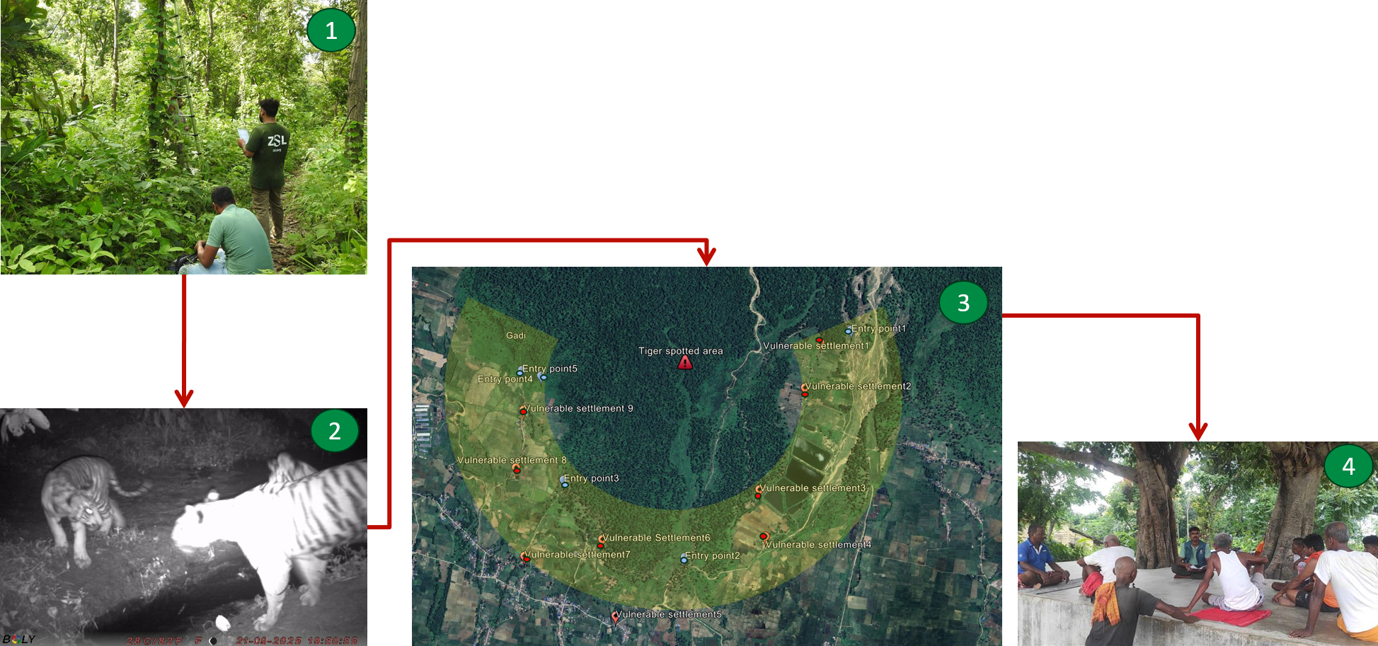
A flow diagram of the process
This blog was produced from a report created by:
Sunjeep Pun
Senior Programme Officer, ZSL Nepal